 Geografía educativa


MAPA CONCEPTUAL DE GEOSISTEMAS

Página Educar Chile con el tema: placas tectónicas.
http://www.bioygeo.info/Animaciones/Huracan_2.swf
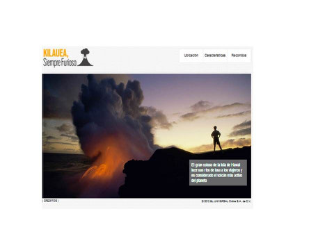
http://www.eluniversal.com.mx/graficos/graficosanimados13/EU_Kilauea/index.html
PÁGINA INTERACTIVA QUE DESCRIBE LA ACTIVIDAD DEL VOLCÁN KILAHUEA, EN EL SUR DE HAWAI
PÁGINA INTERACTIVA QUE DESCRIBE LOS AGENTES INTERNOS QUE INCIDEN EL EL MOVIMIENTO DE LAS PLACAS TECTÒNICAS.
http://www.ig.uit.no/webgeology/webgeology_files/spanish/mantle_dyn_spanish.html
PÁGINA INTERACTIVA RELACIONADA A LAS FORMAS DEL RELIEVE DE EUROPA.
PÁGINA INTERACTIVA REFERENTE A LOS CLIMAS.
PÀGINA INTERACTIVA QUE EXPLICA LOS AFLUENTES DE UNA CUENCA HIDROGRÀFICA
http://www.iesmariazambrano.org/Departamentos/flash-educativos/hidrografica.swf
WIKI MUY INTERESANTE QUE AYUDA A COMPRENDER LAS CAPAS ATMOSFERICAS. DAR CLICK EN EL LINK DE ABAJO.
http://phpwebquest.org/newphp/miniquest/soporte_tabbed_m.php?id_actividad=13038&id_pagina=1
PÁGINA DEL UNIVERSAL CON TEMA RELACIONADO SOBRE EL USO DEL AGUA.
http://www.eluniversal.com.mx/graficos/graficosanimados13/EU_Acuifero_Iztapalapa/mapa.html
PÁGINA QUE MUESTRA LAS FASES DE UN SISMO.
http://estaticos.elmundo.es/elmundo/2003/graficos/jun/s2/terremotos_1.swf
